DES MOINES, IOWA — The Upper Midwest is heading into Sunday with a sharp divide between a relatively calm Great Lakes forecast and a more unsettled picture farther west. The National Weather Service forecast generally dry, seasonable conditions around Chicago through Monday, with highs in the upper 60s to lower 70s. In Iowa, forecasters were monitoring rivers after weekend rain and expected another system to bring possible heavy rainfall Monday night into midweek.
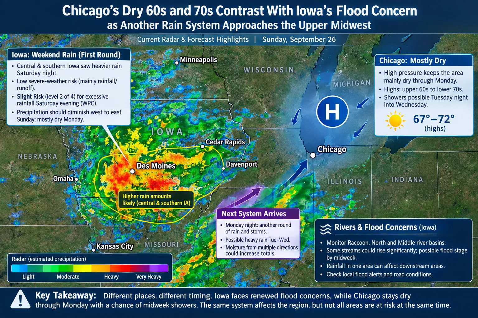
A weather headline covering the entire region should not suggest that Chicago faces the same near-term flood risk as central and southern Iowa. The practical story is where rain has already fallen, where new rain may develop and how those rounds could combine over the same drainage basins.
Iowa’s Weekend Rain Is Only the First Round
The National Weather Service in Des Moines expected rain over parts of Iowa on Saturday, with another round of heavier rain Saturday night. It favored central and southern Iowa for the higher amounts. Its discussion noted that storms could move slowly and produce heavy rain, but it assessed the weekend severe-weather risk as low.
Those details are important for readers who hear the words thunderstorm and immediately assume a tornado outbreak or widespread damaging wind. The Des Moines forecast centered on rainfall and runoff. It did not describe a confirmed statewide flash-flood disaster, and the exact locations of the heavier bands were not settled.
The Weather Prediction Center placed Iowa in a Slight Risk, level 2 of 4, for excessive rainfall Saturday evening. The designation represented a forecast risk, not a statement that all of Iowa would flood. By Sunday, the national forecast expected showers and storms to become more scattered as high pressure built toward the northern Plains.
Rivers Can Respond After Rain Ends
Des Moines forecasters were particularly concerned about cumulative impacts on streams and rivers. Their discussion identified the Raccoon, North and Middle river basins as areas to monitor after repeated rainfall. It said some streams could rise significantly and potentially reach flood stage by the middle of next week.
A river response may outlast the shower that caused it. Rain falling in one part of a basin can continue draining downstream after skies clear elsewhere. That is why a pleasant Monday afternoon would not, by itself, erase concerns if another wet system then arrives at night. Forecast river levels can change as observed rain totals become available, so local gauge and warning information matters more than a broad statewide prediction.
The Des Moines office expected precipitation chances to diminish from west to east on Sunday and described Monday as mostly dry. It then forecast another potent system beginning Monday night, with showers and thunderstorms potentially persisting through Tuesday night. Additional heavy rain was possible as moisture returned from multiple directions.
Chicago Holds Onto a Different Pattern
Farther east, the Chicago forecast office expected high pressure to keep the local area mainly dry through at least Monday. Afternoon temperatures were forecast in the upper 60s to lower 70s, with cooler overnight readings. That is a comparatively quiet start to the week, not a reason to import Iowa’s flood headline into Illinois.
Showers could return to the Chicago area Tuesday night into Wednesday as a system approached from the west. The timing matters: a forecast for rain later in the week should not be written as if heavy storms are already reaching downtown Chicago on Sunday. Conditions across the Great Lakes may change as the system develops, but the September 26 outlook did not support treating the entire area as one immediate emergency.
Why the Forecast Remains Uncertain
Forecasters can identify a favorable corridor for rain before they know which county receives the heaviest band. The Des Moines discussion noted that model forecasts differed on the precise location of weekend rain, while the later-week pattern depended partly on how tropical moisture might feed into the central United States. Those uncertainties should stay visible in the article rather than being edited into a false city-by-city certainty.
For Iowa residents, the most useful preparation is to follow local flood alerts and keep track of roads near streams that have flooded before. Avoid attempting to cross water-covered pavement, even after rain has stopped. Farmers and outdoor workers may also want to account for a narrow Sunday-to-Monday break before the next wet period.
For Chicago-area readers, the immediate forecast supports normal autumn plans with an eye on the possibility of midweek showers. These are two weather stories close together on a map but different in urgency. A credible regional report should give each one its proper location and timing.
