LOS ANGELES, CALIFORNIA — The Pacific Coast is moving toward two different weather changes. Southern California forecasters expect surf of 4 to 7 feet along Los Angeles and Ventura County beaches Monday and Tuesday, when incoming swell and late-morning high tides could cause flooding in vulnerable coastal spots. Farther north, western Washington is forecast to stay mostly dry Sunday before a front brings a broader chance of rain Tuesday.
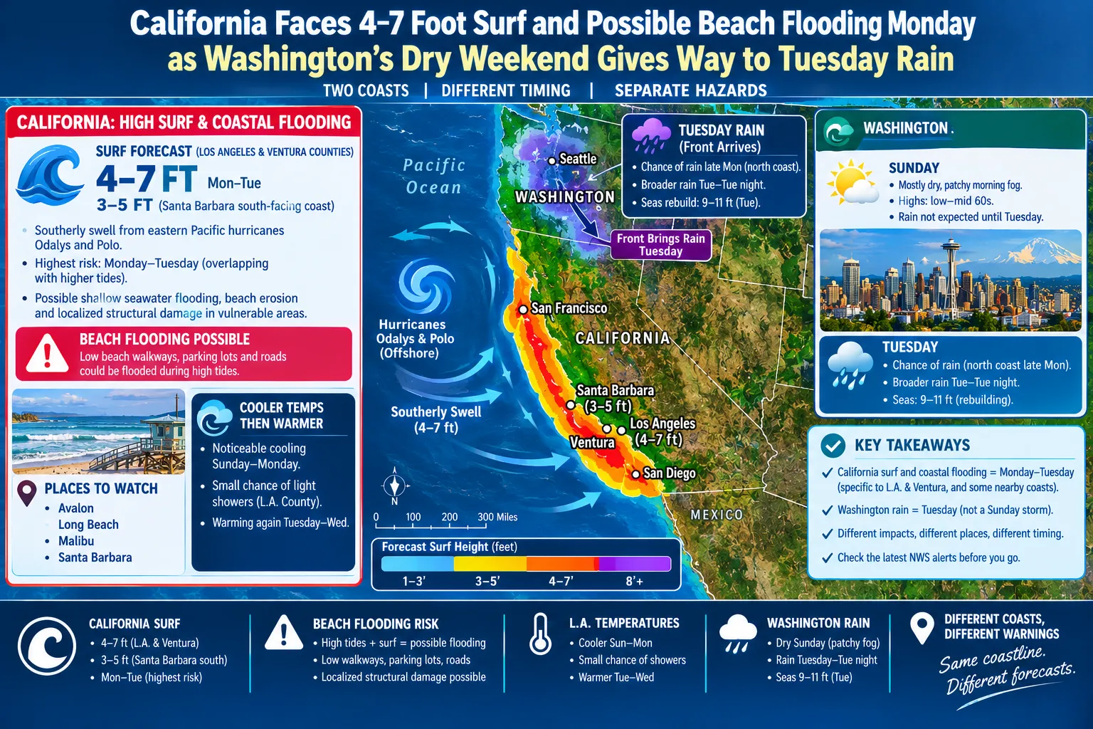
The California surf figure refers to a forecast for Los Angeles and Ventura County shorelines, not every Pacific beach from San Diego to Seattle. Washington’s forecast should also be judged on its own timetable: the Tuesday rain is not an ongoing Sunday downpour.
Southern Swell Arrives With High Tide
The National Weather Service in Los Angeles expects southerly swell generated by eastern Pacific hurricanes Odalys and Polo to affect Southern California beaches. Its Saturday afternoon discussion identified Monday and Tuesday as the most hazardous period because the swell is expected to overlap with higher tides. The office forecast 4-to-7-foot surf in Los Angeles and Ventura counties and 3-to-5-foot surf along the south-facing Santa Barbara coast.
Those numbers describe surf expected at the beach, not a report of structural damage. The forecasters specifically raised concern about possible shallow seawater flooding over low beach walkways, parking lots and roads, along with beach erosion. Localized structural damage was presented as a possibility in particularly vulnerable areas, not as a confirmed consequence.
The office highlighted Avalon, Long Beach, Malibu and Santa Barbara among places to watch. That list does not mean every neighborhood in those cities will flood. Shoreline orientation, harbor exposure and the timing of individual waves all affect where water reaches. A person visiting one beach may encounter a very different situation from someone several miles away.
California Cools Before Warming Again
Away from the water, the Los Angeles forecast expected substantial cooling Sunday and Monday as an upper-level trough moved through the area. Most of the tropical moisture was expected to remain south and east of the Los Angeles forecast area. Forecasters retained only a small chance of light showers in Los Angeles County and also mentioned a few possible showers farther inland.
This matters for accurate weather writing. Tropical cyclones offshore may send hazardous swell to California without sending their strongest winds or a large rain shield onto the coast. A surf headline should not be transformed into a false claim that a hurricane is making landfall in Los Angeles.
After the cooler period, the Los Angeles office anticipated warming Tuesday and Wednesday. Because longer-range temperature forecasts can shift, any separate article about heat should be checked against a newer forecast before publication. In this report, the most immediate hazard remains the Monday-to-Tuesday beach and high-tide combination.
Washington’s Sunday Remains Quiet
The National Weather Service in Seattle expected a dry weekend for western Washington, with patchy morning fog possible and highs generally in the lower to middle 60s. Sunday’s calm pattern was not expected to break immediately. A chance of rain was forecast first for the north coast late Monday, with a slow-moving front bringing a broader area of rain Tuesday and Tuesday night.
For Washington residents, that creates a clear planning distinction. Sunday is the better window for dry-weather activities, while Tuesday could require rain gear and additional travel time. It would be misleading to portray the Washington front as a dangerous storm already battering Seattle on Sunday.
The Seattle marine forecast expected seas to rebuild ahead of the approaching front, potentially reaching 9 to 11 feet Tuesday. Those are projected sea conditions on relevant waters, not breaking surf heights along every Washington beach. As in California, offshore marine measurements and beach surf should not be used interchangeably.
Separate the Hazards by Place
Across the full Pacific Coast, the same headline can accidentally blur distinct events. In Southern California, check coastal flood and high-surf advisories for exposed south-facing beaches Monday and Tuesday. In western Washington, focus on the timing of the Tuesday front and any later marine notices.
Beachgoers should remain back from unexpectedly strong breaking waves and avoid entering water where officials have posted hazards. Drivers near vulnerable Southern California beachfront routes should watch for local high-tide updates. Washington travelers should review the forecast as Tuesday nears. The forecasts share a coastline but do not share one uniform threat, and that difference should remain clear from the headline through the final paragraph.
