Dallas, TX A dangerous day of rain is unfolding across Texas. The Weather Prediction Center has placed parts of the Southern Plains under a Moderate Risk (level 3 of 4) for excessive rainfall on Thursday, October 1. The greatest concern is across south-central Texas, including the Hill Country and the Interstate 35 corridor from Dallas–Fort Worth toward Austin and San Antonio. Forecasters say some areas could receive 2 to 4 inches of rain, with locally higher amounts.
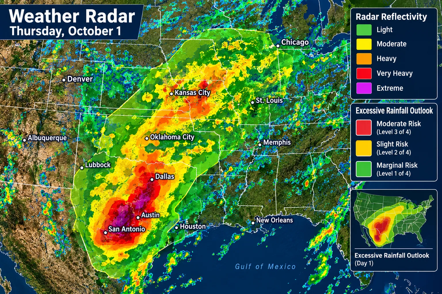
Texas Takes Center Stage
The Moderate Risk extends from South Texas into southeastern Oklahoma. A broader Slight Risk covers parts of Texas, Oklahoma and areas farther north into Wisconsin and northeast Indiana, where scattered flash flooding is possible.
Hill Country and I-35 Corridor Face the Greatest Flood Concern
The Hill Country is especially vulnerable to rapid runoff. Rain rates could reach 1 to 2 inches an hour, with brief, intense bursts potentially higher. Those downpours could cause water to rise quickly in creeks and low-lying areas, while flooding could also affect roads and urban neighborhoods along the I-35 corridor.
Flash Flooding Already Possible Across Central Texas
In an early Thursday update, the Weather Prediction Center warned that flash flooding was likely from the middle Rio Grande Valley into north-central Texas. Forecasters said some storms could produce 2 to 3 inches of rain per hour, with isolated storm totals above 5 inches possible.
Heavy Rain Reaches Beyond Texas
The flood threat extends north and east, where unusually moist air and a slow-moving front could support additional rounds of heavy rain. The WPC outlook includes a broad Slight Risk from Texas toward Wisconsin and northeast Indiana, signaling that flash flooding could occur outside the highest-risk zone too.
Severe Storm Threat Is Low
Thunderstorms are expected across parts of Kansas, Oklahoma and Texas, but the Storm Prediction Center says the overall risk of severe weather is low Thursday. Some storms could still bring gusty winds.
More Rain Could Follow in South Texas
The flood threat may continue into Friday across parts of southern and east-central Texas. The WPC says another 2 to 4 inches could fall from near Laredo to McAllen and nearby areas, with additional heavy rain possible east of I-35 in east-central Texas.
How to Stay Safe
Never drive through floodwater. Water can hide damage to the road, and moving water can sweep vehicles away. Follow local alerts, avoid low-water crossings, and move to higher ground if water begins rising nearby.
